
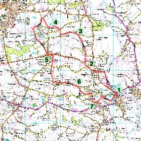
THE WALK: UPTON for 14.07.18
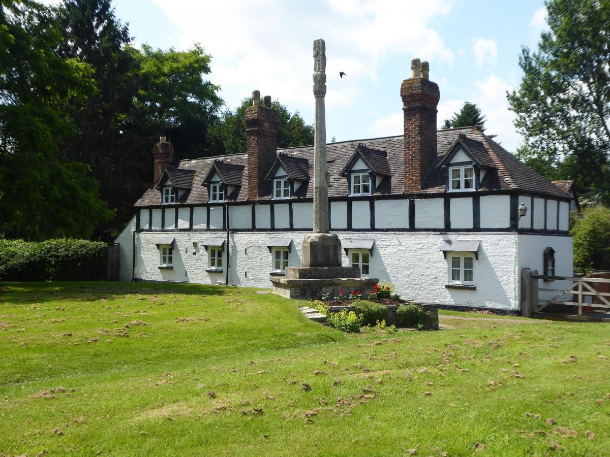
The physical high point of this enjoyable walk is Ox Hill, only 50m high but with good views of the Malverns. There's a bench by the viewpoint which makes a good picnic spot, though it's rivalled by Swan Pool at Hanley Swan, a popular place to take a break.
The walk includes a visit to Boynes Coppice and Meadows Nature Reserve, owned by Worcestershire Wildlife Trust. It is not open to the public (except by special permit) but a public footpath runs through the meadows, offering some opportunity to see the resident butterflies. Brotheridge Green Nature Reserve is also on the route, but has no public footpath through it and access is by special permit only, except for Trust members, who must carry their membership cards. What both these reserves have in common is a stretch of the former Upton-Malvern railway, and you'll walk along an embanked section of this near Upton, where woodland flourishes along its length, with wild flowers on the southern slopes. It runs from the burial ground used in Upton's cholera epidemic of 1832 to the playing fields on the western edge of town.
FACTFILE
START Upton Bridge, Upton upon Severn, grid ref SO850407.
LENGTH 10½ miles/16.8km.
MAPS OS Explorer 190, OS Landranger 150.
TERRAIN Meadows, dairy pasture, arable, woodland, orchards, paddocks; mainly flat.
FOOTPATHS Most are adequate, good or excellent, but some are blocked by crops and waymarking is patchy.
STILES 21.
PARKING Upton.
BUSES First 332/333/363/373, Mon-Sat; firstgroup.com, Traveline 0870 200 2233.
REFRESHMENTS Upton, plus pub at Hanley Castle and pub and shop at Hanley Swan.
DIRECTIONS
I Walk north beside Hanley Road until you can join a footpath after Pool House. It initially heads towards the river, then goes north along field edges and through a garden to a track (Quay Lane) which leads to the road. Cross to a lane opposite and follow it through the churchyard to the old centre of Hanley Castle. Turn left past the Three Kings Inn and along the edge of a cricket ground to join a path which leads to a lane.
2 The path continues almost opposite, close to the right-hand edge of a pasture at first, before bearing left to a gate. Again the path continues opposite, through pasture. Follow the left edge, then go uphill to enter a wood. Walk through it to meet a track and turn left. Cross a stile on the right after 300m, then bear left across a meadow to a stile under a large oak tree. Bear left across another meadow, passing close by a pair of oaks. You'll see a gate opening onto Hangman's Lane, but the path officially goes to a stile in the left hedge, beyond which it should lead to the lane, but is often obstructed by crops. It's maize this year, and though a path was made, it was inadequate. It was usable when this route was checked in June, but that may change.
3 Turn left along the lane and keep left at a junction. Take the second footpath on the right, 300m after Broadacres Farm. Walk across a meadow, cross a brook and proceed to a road. Cross over and turn right, past Blackmore End Cottage, to find a path which passes behind the cottage. It should then go diagonally across a maize field to the far corner, where a footbridge leads into a bean field. However, the path is blocked by maize. It may be possible to get through. If not, follow the road towards the Malverns instead, and take the next path on the right, opposite Blackmore End Farmhouse. It goes along a field edge and is also blocked, but by broad beans, which are easier to trample than maize. Proceed to the footbridge in the corner.
4 Take a fenced/hedged path which goes to the left, and keep straight on at an unsigned junction. After a further 400m you'll see a stile near the edge of a wood. Don't cross the stile but turn right to follow power lines across the field. Continue in the same direction across two more fields to a lane. Turn left, then left again at a grassy triangle to join a bridleway which traverses Ox Hill. Take a footpath on the left after about half-a-mile. It's easily missed, but it's a few paces before a bench near a viewpoint. The path is easily followed through fields, soon descending into a valley where it joins a private drive, which is also a public footpath. Follow it to Hanley Swan and proceed to Swan Pool.
5 Turn left then take the first path on the right, after about 400m, signed to Gilberts End. Keep straight on at a path junction. Go left on meeting a road, then immediately right, signed to Hook Common. Walk towards Hanley Hall, then take an excellent mown path across meadows. After crossing a footbridge, keep to the left field edge to find access to a lane. Cross to a path opposite and follow it to another lane. Brotheridge Green Nature Reserve is just to the right, while our onward route is left, following the lane for a mile (traffic is rare).
6 Take a path on the right, going diagonally through a meadow, then across the course of the old railway to enter Boynes Coppice Nature Reserve. Follow a well-trodden path through the reserve then continue on an obvious route until you enter a nuttery. There's no waymarking, but go roughly straight across to meet a lane opposite Tiltridge Farm. Turn left and take the next path on the right, after 250m. There is no signage but it leaves the road at a hedge gap soon after Little Blossoms. Walk across a pear orchard. The path should go directly across to a footbridge but the trees are planted across the line of the path and you'll probably have to turn right at the other side to find the footbridge. After that, the path leads easily to Hyde Lane.
7 Turn left. After about 100m take another path on the left. Pass farm buildings then bear right to enter paddocks and keep straight on. There is no waymarking but the path is fairly obvious. When you come to a slope, descend left by a fence. Cross a stile at the bottom, go past the cholera burial ground and a sewage works, then turn right on an unsigned path which runs along the former railway embankment. It leads to playing fields on the edge of Upton, where you can turn either left or right for the town.
PLEASE NOTE This walk has been carefully checked and the directions are believed to be accurate at the time of publication. No responsibility is accepted by either the author
or publisher for errors or omissions, or for any loss, accident or injury, however caused.
© Julie Royle 2018
From: Julie Royle
Sent: 02 July 2018 19:50
To: MS-Worcester Editorial
Cc: Chris Vaughan
Subject: The Walk - Upton - for 14.07.18


Comments: Our rules
We want our comments to be a lively and valuable part of our community - a place where readers can debate and engage with the most important local issues. The ability to comment on our stories is a privilege, not a right, however, and that privilege may be withdrawn if it is abused or misused.
Please report any comments that break our rules.
Read the rules here