


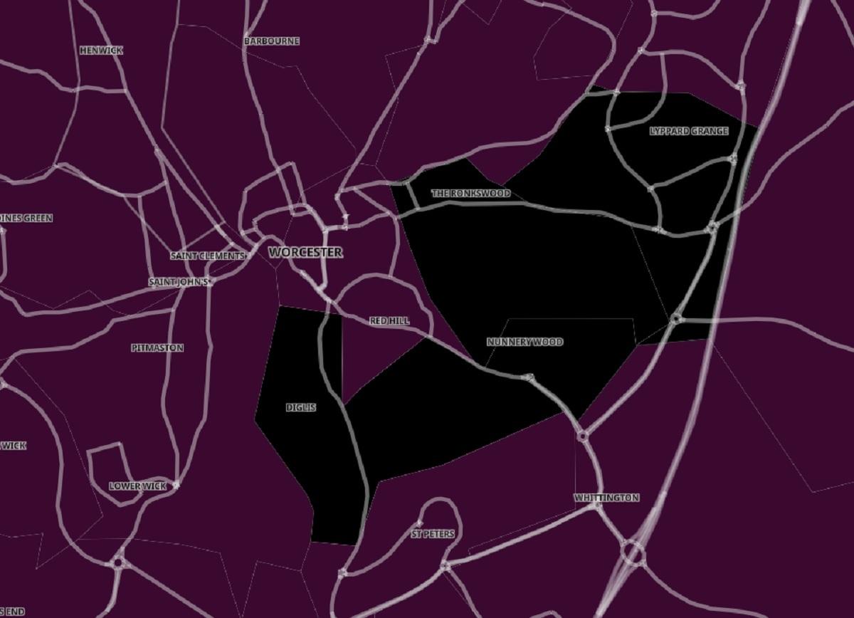
THREE parts of Worcester have coronavirus infections so high they are now in a new highest "black" category on the Covid map.
In this category is Ronkswood and Nunnery Wood, which has an infection rate of 1,849.9 per 100,00 people with 120 cases - the highest in the city.
Also appearing in the top category are Lyppard Grange which has an infection rate of 1,801.7 per 100,000 with 107 cases recorded in the week up to New Year's Eve, and Battenhall and Diglis which is at 1,738.9 per 100,000 people with 146 cases recorded that week.

On the cusp of entering the top category is Lower Wick and Bromwich Road, which has an infection rate of 1,529.5 per 100,000 people with 124 cases that week, and Barbourne and Rainbow Hill that has an infection rate of 1,544.0 per 100,000 people with 124 cases.
St Peter's could also soon cross into the highest category, as it has an infection rate of 1,525.4 per 100,000 people with 81 cases, as well as Warndon East that has an infection rate of 1,574.4 per 100,000 people with 99 cases recorded that week.
Henwick currently has the lowest case rate in the city, an infection rate of 1,011.4 per 100,000 with 56 cases.
Areas with infection rates above 800 cases per 100,000 people were previously placed in a dark purple category that was once the highest category on Public Health England's (PHE) coronavirus map.
But after Omicron hit, PHE added another category where case rates are more than 1,600 cases per 100,000 people, colouring that black on the interactive maps on the government's website.


Comments: Our rules
We want our comments to be a lively and valuable part of our community - a place where readers can debate and engage with the most important local issues. The ability to comment on our stories is a privilege, not a right, however, and that privilege may be withdrawn if it is abused or misused.
Please report any comments that break our rules.
Read the rules here